
Digital Transformation in Infrastructure
Q1. You’ve worked in geospatial technology and digital transformation for construction and infrastructure projects for over 25 years — could you start by giving us a brief overview of your roles and responsibilities across areas like remote sensing, BIM, GIS, and large rail/infrastructure programs?
Over the last 26 years, my career has been about using geospatial and digital technologies to solve complex problems across defence, utilities, aviation, and now large construction and high-speed rail. I started as a geologist and remote sensing specialist, working hands-on with satellite image processing, applied geological mapping, and GIS for organisations like ISRO, DRDO, AAI, NRSC, BSNL and several central government agencies, where we built mission-critical solutions in areas such as glacier monitoring, avalanche hazard mapping, groundwater assessment, and utility asset management.
From there, I moved into enterprise geospatial and solution consulting, leading GIS, Web GIS and remote sensing solution design, pre-sales and technical marketing for government and PSU clients. In this phase, I was responsible for architecting and deploying large-scale land and asset management systems, AM/FM GIS for utilities, and enterprise geospatial platforms that integrated cadastral, utility, terrain, and infrastructure data to support strategic and operational decision-making.
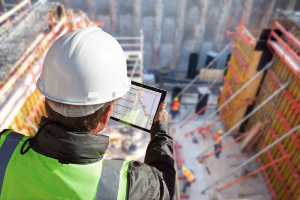
In the last 11+ years at L&T Construction’s Heavy Civil Infrastructure IC, my role has evolved into leading digital transformation for mega linear infrastructure projects. I currently head Digital for the Mumbai–Ahmedabad High Speed Rail project, where I drive the adoption and integration of BIM, BIM–GIS, LiDAR, 3D laser scanning, drone-based monitoring, IoT, sensors, RFID, AR/VR for safety, robotics, and computer vision into one coherent digital ecosystem. The focus is on building digital twins, 4D/5D construction workflows, asset lifecycle frameworks, and command-centre–style visibility so that project leaders and the C‑suite have real-time, data-driven insights on progress, risk, and productivity.
Alongside my technical leadership, I bring 6+ years of strategic experience in technical marketing and pre-sales, which helps me communicate business value, build internal and external buy-in, and shape value-driven digital roadmaps. Overall, my responsibility today is to bridge field realities, engineering, and advanced digital technologies—remote sensing, GIS, BIM, IoT and automation—to continuously improve visibility, safety, and performance on large, complex infrastructure programs.
Q2. As BIM and full digital twins become standard on large transportation and urban-infrastructure projects, what are the most practical use cases you’re seeing beyond design coordination — for example, in construction sequencing, site safety, or handover to operations?
Construction Sequencing & Planning (4D/5D):
4D scheduling helps in planning Construction activities and also gives an idea of the impact on any delayed activities
5D Integrates quantities and costs for a more reliable schedule and cost forecasting. It also helps the project team identify a more accurate quantity of material for prompt, smooth procurement. This also helps in proper working capital management in projects.
Simulation of precast units, such as a casting yard with the movement of different equipment, helps improve production planning.
Site Safety & Risk Analysis
Integrating the model with real-time utility helps identify and reduce clashes before construction.
Simulating different movements of Heavy construction equipment in the BIM environment helps the team anticipate potential Safety risks, such as crane paths.
AR/VR-based safety training to Workmen before the physical structure is ready.
Logistics
Material delivery routes inside congested sites can be checked for feasibility. Like the movement of a precast element below a high-tension wire.
Operation and maintenance
Simulations for emergency response and capacity optimisation, like in stations, buildings, etc.
Real-time monitoring integrating the BIM model with different IOT devices.
Q3. You’ve worked across remote sensing, LiDAR, drones, and 3D laser mapping for years — how is the industry now combining these data sources with BIM / GIS to enable near real-time progress tracking and risk detection on mega-projects?
I would like to add GPR (Ground Penetrating Radar) to this list. The integration of remote sensing, LiDAR for surface topography, and drones to capture real-time surface topography and monitor project progress using different payloads. For structures like buildings and public utilities, such as stations and stadiums, indoor construction can be monitored in real time using 3D laser mapping.
The integration of remote sensing, GPR, LiDAR, and 3D laser mapping with BIM/GIS provides a Real-time digital twin setup where all utilities, uncharted or chartered, sub-surface, on-surface, and over-surface, are mapped. This helps in project planning, Scheduling and execution.
The LiDAR and GPR data help us identify topography and real-time utility. Once this is superimposed on the BIM model, it shows potential clashes and gives the team breathing space to make design changes before execution begins.
Once execution starts, this integration helps determine the critical path and schedule execution properly. Also, it easily captures physical progress at periodic intervals. This integration helps the project team to submit as-built drawings to the project sponsors as a project close document.
Q4. With more sensors, IoT devices, and computer-vision systems being deployed on construction sites, what are the key challenges you see around data quality, interoperability, and governance — and how are leading project owners and EPCs addressing them?
Data quality:
- Different data sources: Because most of these services are provided by different vendors, the data from each vendor is in different formats and data structures.
- Sensor drift and Inaccurate calibrations – with time, long-term use and ageing, there is a gradual, unintended change in a sensor's output over time.
- Human dependency: Manual tagging of sensors.
Interoperability:
- Different Platforms: LLS, flow meter sensors, RFID, and cameras working in different platforms
- Proprietary data schemas: Each system has its own tagging, metadata structures, and APIs.
- Lack of real-time integration: Integration, even if happening, is not real-time
Governance:
- Ownership of data: EPC vs. subcontractor vs. technology vendor — unclear rights often create disputes.
- Cybersecurity risks: IoT sensors and unsecured devices are easy attack vectors
- Regulatory compliance: Worker privacy
- Uncontrolled data growth: Massive volumes of data generated by CCTV feeds for CV
Project owners and EPCs are addressing it by following:
- Device standardisation: Approved vendor lists and pre-calibrated equipment to reduce variability.
- Training: Training of field executives and online Structured workflows for photos, scans, and daily logs to reduce human error.
Common Data Environment:
- Owners require vendors to expose open APIs and integration support as part of Work orders.
- Common WBS or nomenclature of identifiers for better data integration.
- Clear governance frameworks: Policies that define who owns the data, how long it’s stored, and who can access it (role-based access).
- Data lifecycle management: Rules for retention, compression, archival, and purging — especially for large CV datasets.
Q5. Many governments and project sponsors are pushing for “digital by default” delivery on new infrastructure. From your experience, what tends to make the difference between a tick-box digital initiative and a genuinely value-creating construction digital-transformation program?
In a country like India, with a fiscal deficit mostly from the Government, private developers, contractors, everyone is focused on the cost part of any project; hence, even if the initiatives by the Government and Project sponsors seem like a tick box digital initiatives, they are having a very positive impact and clearly showing the benefits industry-wise.
A tick-box digital initiative focuses on tool development and implementation, but a value-creating digital program focuses on behaviour change, data quality, and measurable business outcomes.
However, I will point out some points that tend to make the difference between a tick-box digital initiative and a genuinely value-creating construction digital-transformation program.
- Project directors and BU leadership regularly review digital KPIs, monitor adoption and tie digital performance to review cycles. This keeps the normal employees motivated to adopt the digital solutions. In our BU, we have a monthly digital scorecard with detailed digital adoption scores department-wise and project-wise, sent to all Employees. We also recognise the Champions and felicitate them with Prizes every month.
- Real issue solved, not used as compliance. All digital solutions should be developed by keeping the end user at the centre, solving their problems or easing their day-to-day work. We have started a Fuel management system across our 237 KM stretch, which has successfully helped stakeholders dispense 70K litres of HSD to our huge fleet of 2000+ assets. This solution was very successful, easy to implement, and adopted by all stakeholders involved, as it made their day-to-day operations and decision-making very smooth. They had more time to focus on other strategic works.
- Bottom-up initiative and top-down implementation. The solution request or requirement should come from end users as per their need, and the solution development and implementation drive should come from the project leadership. This is the formula of digital transformation we follow in a Projectized environment. In this process, all the stakeholders feel involved and important at each stage. We practice this approach while developing the Quality management application. Implementing a robust laboratory management system ensures that mega linear construction projects maintain the highest standards of quality, efficiency, and compliance throughout their lifecycle.
- Agile Method implementation. Rather than developing a very big and complex application, going step by step, module by module, with implementation of a digital solution, not only helps us in reducing the development time but also generates user feedback for further improvement in subsequent modules, and it is easily implemented, and user adoption is also ensured with minimal training.
Continuous improvement
Q6. Looking ahead 3–5 years, how do you expect advances in AI (for example, vision-based defect detection, schedule risk prediction, or generative design) to change the way complex linear projects like high-speed rail or expressways are planned and executed?
The next 3-5 years are instrumental for the infrastructure industry, as the government, project sponsors, and contractors are finally taking an interest in new technology and are heavily supporting digital transformation initiatives within their respective companies. From a construction industry perspective, the following are future realities.
Computer vision is becoming routine. The wide use of Computer vision technology for quality and safety processes. Also, the introduction of computer vision technology for the time-motion study of different processes.
AI in contracts management. AI is playing a big role in contract management for gaining an edge in tenders, Risk identification and mitigation, and risk prediction.
Advanced analytics for project control and optimisation. Advanced analytics used as a decision support system for asset utilisation, resource deployment, planning and execution.
AI-driven logistics and resource optimisation. IoT and asset sensor data are fed to AI models to better understand and manage logistics and resource planning.
Smart inventory management and procurement system. The integrated system will work as a single entity to ensure minimum inventory handling and storage costs and to make sure the right resource is at the right place at the right time.
In short, in the next 3–5 years, AI will move linear projects from periodic human-driven control to continuous, predictive, and semi-autonomous execution.
Q7. If you were an investor evaluating companies that claim to be leaders in digital construction, BIM, and geospatial infrastructure solutions, what critical question would you ask their leadership team before deciding whether to back them?
- What business outcomes do your customers reliably achieve using your platform—quantified, not anecdotal?
- How do you ensure interoperability across BIM, GIS, IoT, planning, and ERP systems?
- How many of your customers have adopted your products after the pilot phase and scaled them enterprise-wide?
- How much of your revenue is from repeat customers and how much from new customers?
- What new products are in the pipeline of development?
- In the next 3-5 years, which parts of the construction lifecycle will you dominate?
- Which enterprises do you think are your competitors?
- What percentage of your PAT goes back to product development and R&D?
- Which new technology partner are you planning to partner with?
Comments
No comments yet. Be the first to comment!